
Highway Safety Information System receives continued funding
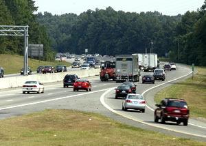
For many researchers, acquiring data to study the safety of our roadways used to be a lot more difficult. That changed in 1990 when the Highway Safety Information System (HSIS) was launched as the nation’s only multi-state database that includes both crash and non-crash safety data.
The concept for HSIS was developed in 1987 under the direction of Dr. Forrest Council, former HSRC director and HSIS principal investigator. “We wanted to develop a system, not just a database, that could be used to answer the most critical highway safety questions,” said Council.
The HSIS now offers data from nine states as well as two urban areas. These states and municipalities were chosen for the quality of their data, their ability to link crash data with road inventory data, and their willingness to work with the HSIS staff to provide and improve the data. Some states also provide unique data to the system, such as road curvature, expanding the database and the list of safety issues that can be addressed. In return for their participation, the HSIS staff provide quality assurance on the data received and feedback to the states regarding any anomalies discovered.
The HSIS is used most often by researchers to evaluate the safety effectiveness of engineering countermeasures and to determine the relationships between characteristics of the roadway environment and crashes. The results of these research efforts are provided to engineers, planners and policy makers and help them to make better decisions about where to spend their limited resources for safety improvements and what changes are needed in the design, operations and maintenance of their roadways.
HSIS staff also conduct research using the data. Recent studies have included an investigation of collisions involving passenger cars and large trucks, safety analysis of rumble strips, and a crash analysis of collisions involving pedestrians and motor vehicles on rural roads. In addition to conducting research, the HSIS has served as a mechanism for producing analysis tools for practitioners. The Pedestrian and Bicycle Crash Analysis Tool (PBCAT) and the Geographic Information System (GIS) Safety Analysis Tools were both upgraded recently and are available for download on the HSIS Web site.
The HSIS will continue operations for the next five years with the recently awarded $5.8 million in funding from the U.S. Department of Transportation Federal Highway Administration (FHWA).
“With renewed funding, we will continue to provide the data to enable researchers to answer key roadway safety questions. At the same time, we will explore the possibility of adding additional states and urban centers to the system in the near future,” said David Harkey, HSRC director and HSIS principal investigator.
For more information on the Highway Safety Information System, please visit www.hsisinfo.org.
![]()
The University of North Carolina Highway Safety Research Center
730 Martin Luther King Jr. Blvd, Suite 300 | Campus Box 3430 | Chapel Hill, NC 27599-3430
Phone: 919.962.2203 | Fax: 919.962.8710
http://www.hsrc.unc.edu